
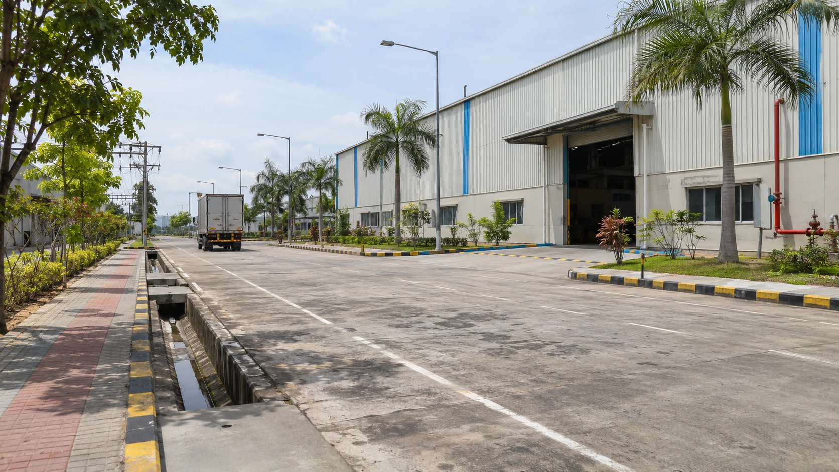
RANIHATI–AMTA ROAD, HOWRAHWell connected.
Well connected.
Well positioned.
Find the project in Howrah, West Bengal. The brochure connects the location with NH16, Kolkata, ports, rail freight and the wider industrial corridor.
THE PROJECT ADDRESSPlan your visit
Plan your visit
to Howrah.
Ranihati–Amta Road
Howrah, West Bengal, India
Contact the team for the current entrance, appointment and safe access information before travelling.
Open Map SearchSTRATEGIC CONNECTIVITYA useful first view
A useful first view
of the distances.
The figures below are quoted from the supplied brochure. Verify actual routes, vehicle suitability and current travel times independently.
Dhulagarh Toll Plaza
Sankrail Goods Yard
Howrah Railway Station
Howrah Bridge
Vidyasagar Setu
Khidirpur Dock
NSC Bose International Airport
Haldia Port
Panchla Police Station
Nearest hospital
DIRECTIONS FROM KOLKATAFollow the corridor.
Follow the corridor.
Confirm the final approach.
The brochure’s six-step route is an indicative guide. Its map is not to scale.
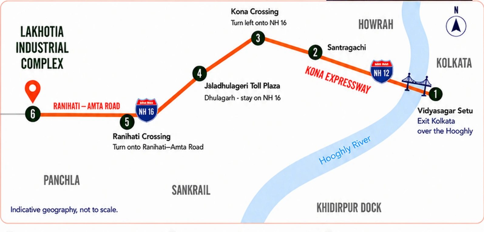
Vidyasagar Setu
Cross the Hooghly from central Kolkata onto Kona Expressway, as shown in the brochure.
Santragachi
Continue along the expressway past Santragachi.
Kona Crossing
Turn onto NH16, described in the brochure as Bombay Road, heading south-west.
Dhulagarh
Pass the Jaladhulagari Toll Plaza and stay on NH16.
Ranihati Crossing
Turn onto Ranihati–Amta Road, heading west.
Arrive at the project
Continue to Lakhotia Industrial Complex on Ranihati–Amta Road. Confirm the exact entry point before travelling.
HOWRAH & THE WIDER ROAD NETWORKConnected locally.
Connected locally.
Thinking regionally.
Ranihati–Amta Road provides the local approach. The brochure places NH16 / Mumbai Road approximately 4 km from the complex. Beyond that, regional corridors support route planning across eastern India.
NH16 / Mumbai Road
The nearby highway is described as Mumbai Road in the project brochure. West Bengal PWD identifies the NH16 stretch through Dankuni and towards Kharagpur. Review the actual junction, approach width and freight access during a site visit.
Delhi-bound road network
The wider Kolkata–Dankuni road network links with NH19, the Delhi–Kolkata corridor. This is a regional road connection; the distance from the complex to a suitable NH19 junction has not been independently measured.
North Bengal & Northeast India
Regional distribution planning can consider the road network through North Bengal and the Siliguri corridor towards Assam and the Northeast. NH12 runs from the Kolkata region towards Dalkhola, with onward northern highway connections. Confirm the route for each destination and vehicle type.
A clearer distinction for route planning
NH16 / Mumbai Road near Howrah and the Delhi–Mumbai Expressway are different roads. Government records place that expressway outside West Bengal. The complex should therefore be evaluated for its nearby NH16 access and wider regional connections, rather than advertised as being beside the Delhi–Mumbai Expressway.
For a factory or distribution centre, compare actual dispatch destinations, tolls, truck restrictions, last-mile access and loading schedules. No transit-time or freight-cost saving is guaranteed.
Plan a route-focused site visitConnectivity research and source notes
Reviewed 18 November 2026. The project’s approximately 4 km distance comes from its supplied brochure. Regional network descriptions are a planning interpretation of the public sources below, not a surveyed route or direct transport service.
Development scale, distances and facilities are described in the supplied brochure. Confirm current availability, approvals, completion and service arrangements with the project team. Read the brochure
THE COMPLETE PROJECT BROCHUREUnderstand the plan.
Open the Lakhotia Brochure Understand the plan.
Prepare your next move.
Review the development scale, layout, operational support facilities, consulting services and connectivity information in one document.